
During the late 1950s, the commissioning of a spy satellite program marked a significant milestone. The program commissioned the launch of Corona spy satellites from Vandenberg Air Force Base in 1960. These satellites orbited the Earth, capturing over 850,000 images from 1960 to 1972. Their primary objective was to monitor potential military threats worldwide, with a particular focus on the USSR during the Cold War. The CIA constantly updated the surveillance targets based on gathered intelligence. The satellites followed a polar orbit and encountered numerous challenges and setbacks throughout the program. To retrieve the exposed film, they utilized parachutes to drop it back to Earth.
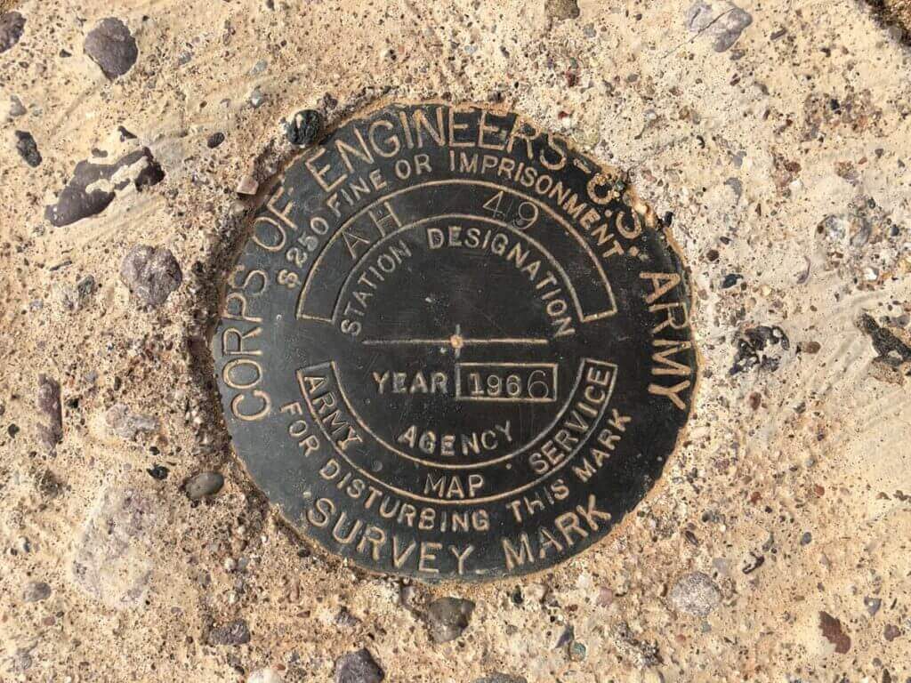
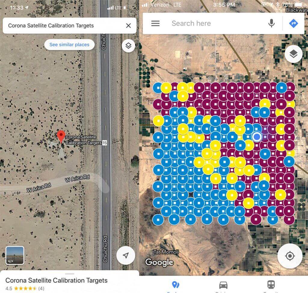
However, the most remarkable aspect of this story is not the engineering feats involved in building, launching, and film retrieval but rather the existence of the Corona Targets. The Corona Targets consist of 272 concrete crosses with survey markers at their centers, arranged in a 16×16 grid near Casa Grande, Arizona. Although we acknowledge the presence of trap doors on the east side of each target, their purpose remains uncertain. While farmers have destroyed or obscured some targets, many remain accessible and relatively easy to visit. The provided map categorizes the targets with different colors: blue for targets in good condition, yellow for damaged ones, and red for missing targets.
1995 President Clinton signed executive order 12951, releasing CORONA, ARGON, and LANYARD imagery to the public. These satellites, launched from Vandenberg Air Force Base in 1960, captured over 850,000 images between 1960 and 1972. They aimed to photograph potential military threats worldwide during the Cold War, focusing on the USSR. The targets of surveillance changed based on intelligence gathered by the government. The satellites followed a polar orbit, swiftly capturing images circling the planet. To retrieve the film, it was jettisoned from the satellites in canisters equipped with parachutes, which were then intercepted and brought back to the base by military aircraft.
While the engineering involved in constructing, launching, and retrieving exposed negatives is impressive, the true fascination lies in the Corona Targets. These targets, identifiable as concrete crosses with survey markers, hold the most compelling part of the story. Many of these markers can still be found and explored using Google Maps. Numerous accessible targets allow curious individuals to stop by and take a closer look. However, conducting thorough research and adhering to any posted signs before visiting these areas is essential.
Discovering the targets sparked curiosity and conversations about their historical significance and impressive engineering. These objects hold a fascinating piece of American history, often overlooked by passersby. Photos by @rscottjones. Follow his Instagram account for captivating Southwest shots and epic park adventures.
Have you visited any of the targets?
As always, happy trails and stay adventurous, my friends.
[frontpage_news widget=”1312″ name=”Posts block”]