
Zion National Park – Utah
The History of Zion National Park
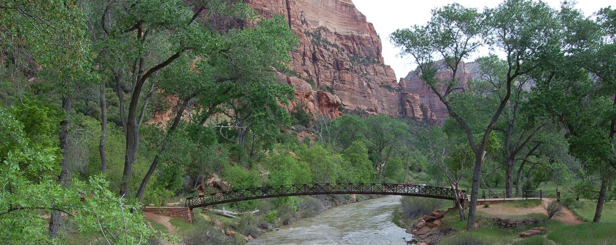
Zion sits in the southwest corner of Utah, where the Virgin River has spent millions of years cutting down through sandstone to carve the canyon you see today. The walls climb as high as two thousand feet straight up from the canyon floor, banded in cream and pink and deep red. It is one of the most vertical, closed-in landscapes in the whole park system, and standing at the bottom looking up is the kind of thing a photograph never quite gets right.
The People Who Came First
People have lived in and around this canyon for thousands of years, long before any map carried the name Zion. Ancestral Puebloan people were here first, and later the Southern Paiute, who knew the canyon as Mukuntuweap. When Mormon settlers reached the canyon floor in the 1860s and started farming it, a man named Isaac Behunin is the one usually credited with the name Zion, a word that meant a place of peace and refuge. He is supposed to have said that a man could worship God among these cliffs as well as he could in any church, and that this was Zion. The name stuck, even though the area carried the name Mukuntuweap for years after.
From Monument to National Park
Zion was first set aside as Mukuntuweap National Monument in 1909, under the Antiquities Act. The Paiute name was hard for most visitors to pronounce, and there was a real worry at the time that people would not bother coming to a place they could not say out loud, so in 1918 the monument was enlarged and the name was changed to Zion. The following year, on November 19, 1919, Congress established it as a national park. It was the first national park in Utah, and it took decades for the crowds to find it. In the early days the trip out here was rare enough that fewer than a thousand people a year made it.
The Shuttle and the Crowds
They found it eventually. Zion got so popular that the main canyon road could not handle the cars anymore, and in 2000 the park brought in a mandatory shuttle for Zion Canyon during the busy months. Private vehicles have been kept out of the canyon for most of the year ever since. It is worth knowing before you go, because the way you move through Zion today is not the way visitors did even a couple of decades back.
Know Before You Go
- Region: Southwest United States
- Location: Springdale, Washington County, southwest Utah
- Address: 1 Zion Park Blvd, Springdale, UT 84767 (Visitor Center)
- Coordinates: 37.2982, -113.0263
- Costs: NPS Fee $20 – $35; America the Beautiful pass accepted
- Schedule: Park open year-round; the Zion Canyon shuttle runs most of the year and is required to access the main canyon during peak season. Check the NPS site before you go.
- Attraction Type: National Park
- Activities: Hiking, canyoneering, scenic driving, photography, wildlife viewing, the Riverside Walk, the Narrows, Angels Landing (permit required)
- Notes:
- The Zion Canyon shuttle is mandatory in the main canyon during the busy season. Plan to park in Springdale or at the visitor center and ride in.
- Angels Landing now requires a permit obtained through a lottery. Do not show up expecting to hike it without one.
- The Narrows means walking in the Virgin River itself. Check flow rates and flash flood warnings before you go, because conditions change fast.
- Summer is hot and crowded. Spring and fall are far more comfortable, and the canyon holds weather of its own, so be ready for rain.
- Additional Resources: NPS Official Site
My Visit
I came through Zion in 2006 with my brother on a road trip home from Arizona. It was the second day of the drive, and it rained most of the morning, the kind of steady gray drizzle that follows you down the highway and does not let up. We did not have the kind of time the place deserves. We came at it through the switchbacks and watched the canyon open up around us, the clouds hanging low and catching on the tops of the cliffs, and we took in what we could before we had to move on toward Bryce.
Even rushed, even in the rain, Zion stuck with me. The scale of it does something to you. The walls go straight up on both sides and the Virgin River runs along the bottom, and you feel closed in and wide open at the same time. We barely scratched the surface. There are miles of trails here and whole days a person could lose in this canyon, and we dipped our toes in and kept driving. I left wishing we had given it more, and knowing I would have to come back. Some places only need a few minutes to make their case.
Photos from My Visit


Zion was one of the headline stops on a 2006 road trip through the Southwest, and it sits in good company. If you want more national park units from real visits, there are several others in the Places section.
Grand Canyon National Park – South Rim was the stop just before Zion on that same trip and is the kind of place no photograph prepares you for. Bryce Canyon National Park was the second half of that same rainy day, a landscape as open as Zion is vertical. Oak Creek Canyon near Sedona is where that drive really began, red rock and green trees and water all at once.
If you want to see everything in the National Park Units section, the full list is here.
The newsletter is where I share the extra stuff: finds, trip notes, and places that do not always make it to the blog. Subscribe on Substack if you want to follow along.